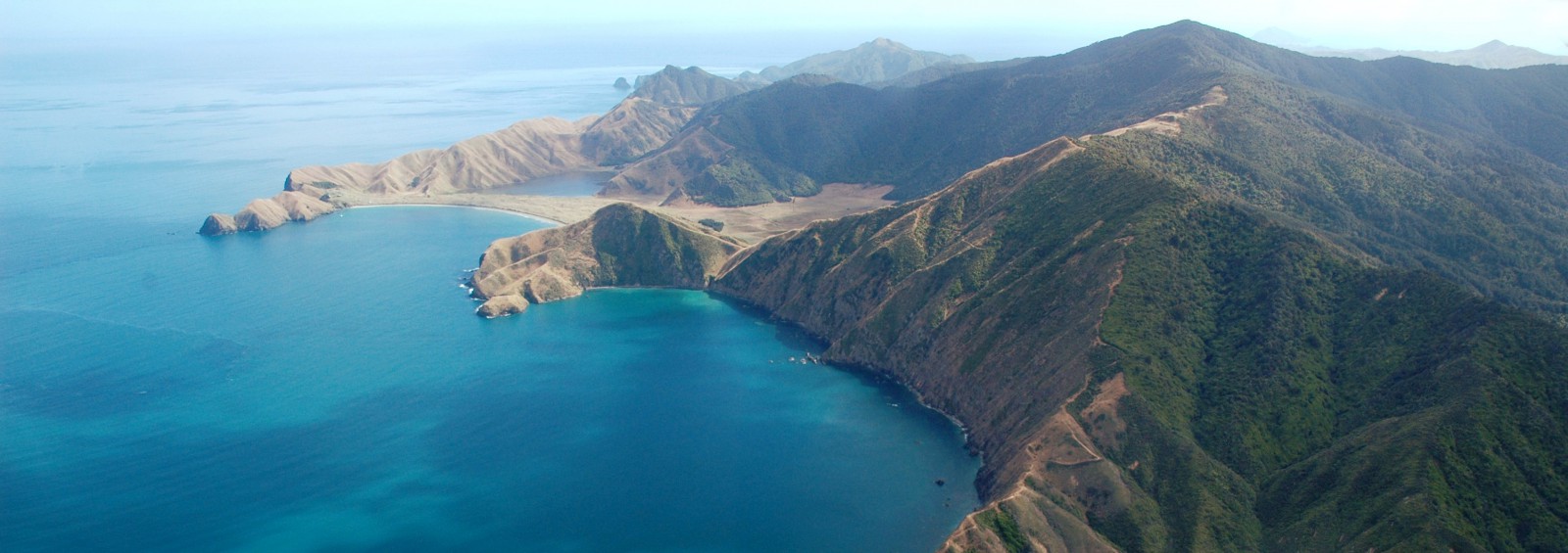
As a result of Waitangi Treaty settlement agreements this location now has a dual place name; Greville Harbour / Wharariki
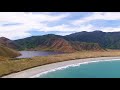
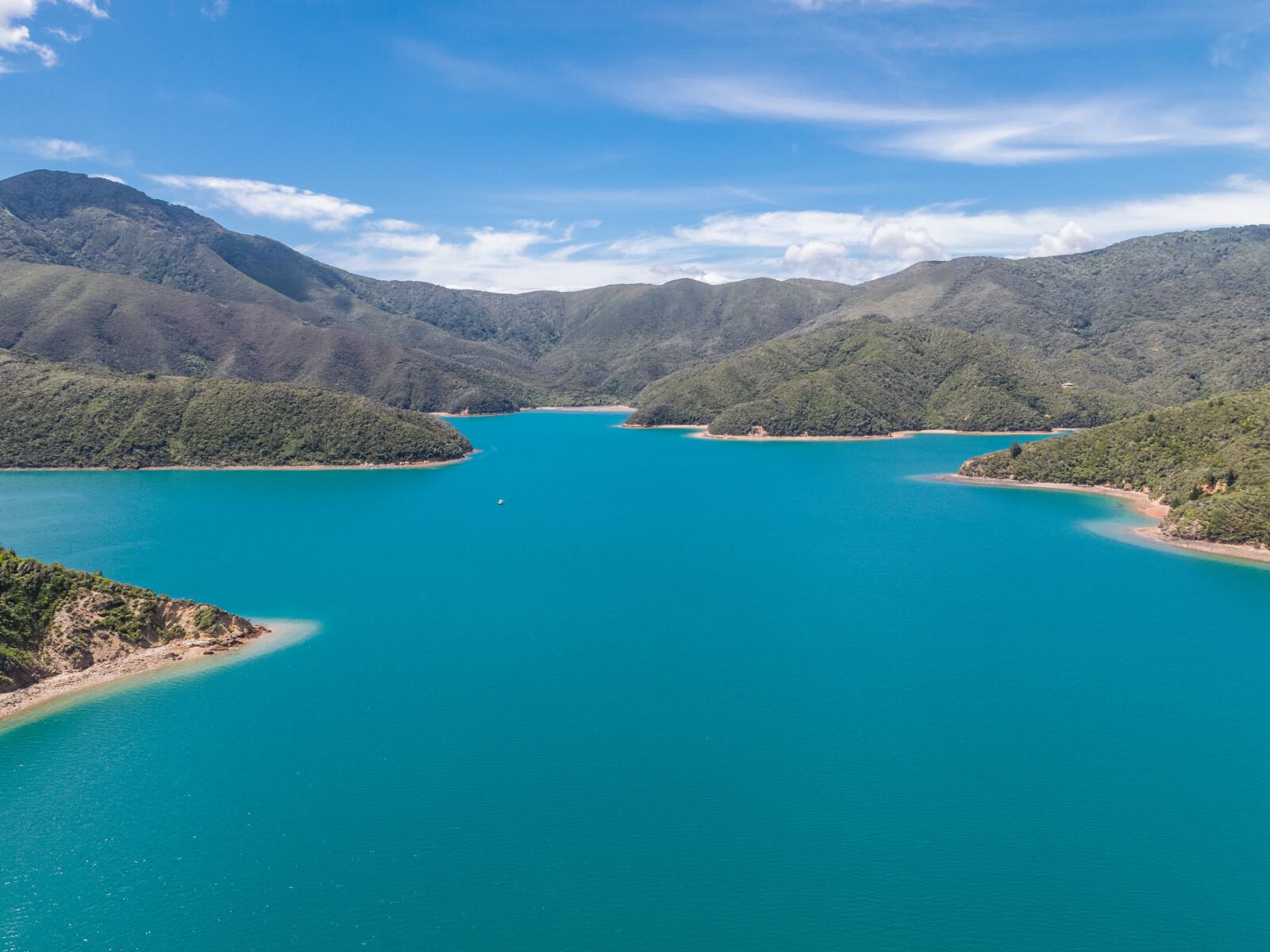
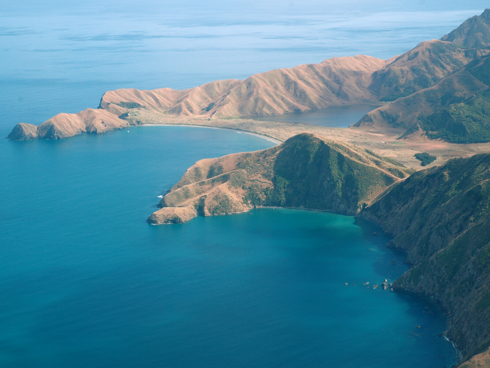
Greville Harbour has a reputation as an extremely attractive and well protected anchorage. The entrance to the harbour is 1.1 miles wide, between Ragged and Two Bay Points.
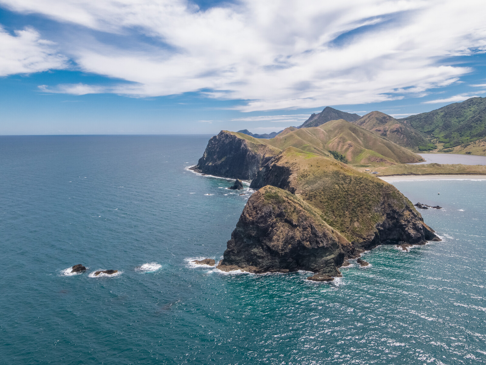
Araiawa Island is a small cluster of rocks approximately 150 m north of Ragged Point. To the east of this cluster of rocks, there is a shoal with under 1 m of water over it at low water.
The outer part of Greville Harbour is open to both sea and wind and does not give any satisfactory overnight anchorages. There are however, pleasant beaches and some shelter from sea breezes. The coastline into the harbour from Ragged Point south has outlying rocks as indicated in the sketch. The beach, just inside the point, is often used during the day as a picnic spot. The southern end of the outer part of the harbour is open to most winds and should not be used other than as a temporary stopping place. There is a farm house here and it is usually possible to obtain information about local conditions from the residents.
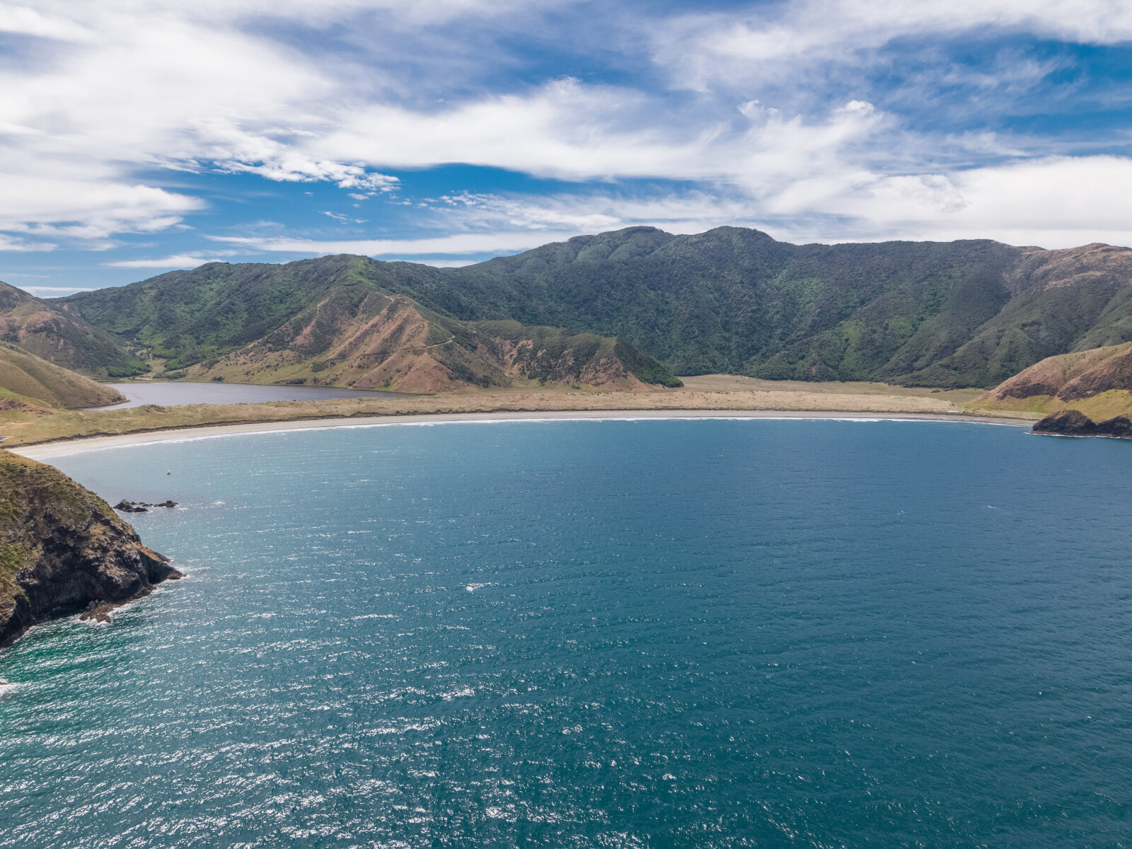
The large bay to the east of Two Bay Point is very shallow and boats should keep at least 100 m from the shore. Only at the northern end is it possible to anchor near the shore and be sheltered from the sea breezes. The bay is open to all S winds. A freshwater lagoon backs onto the beach.
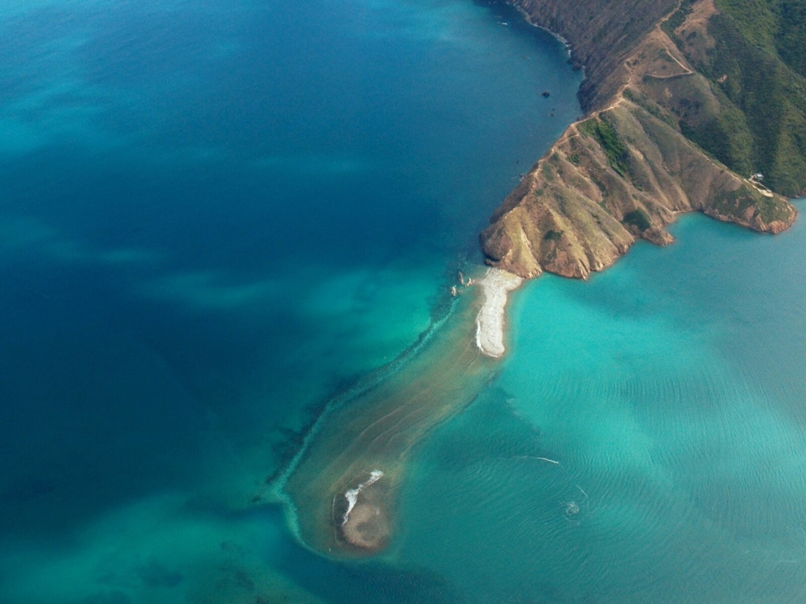
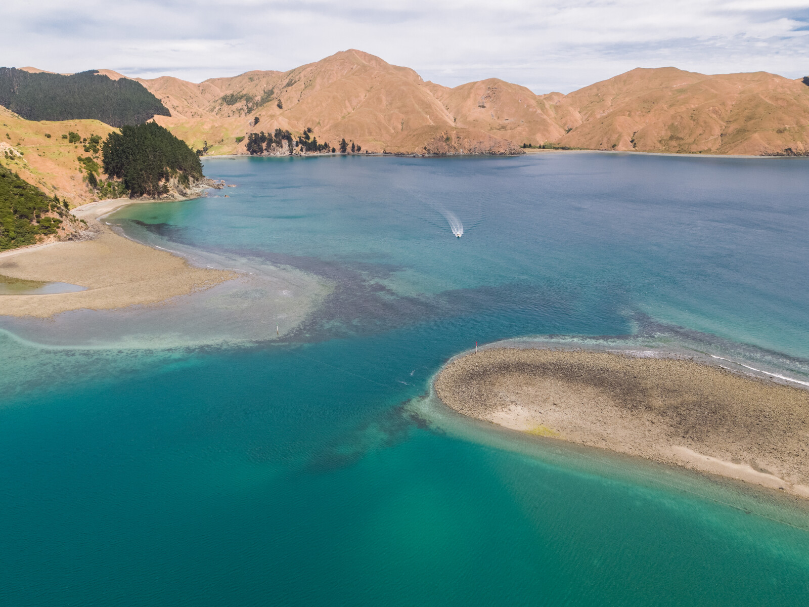
The boulder bank divides Greville Harbour in two and shelters the inner harbour from the sea. The channel through the boulder bank is clearly marked by port and starboard beacons. The sketches show the details of the boulder bank and the preferred method of entering.
The port beacon should be given a clearance of at least 10 m and the starboard beacon about 20 to 30 m. There is adequate depth in the deepest part, between the beacons, but the sea bottom shallows on the seaward side to approximately 1.6m at LWS. The bottom on the seaward of the side of the entrance is shingle and boulders covered with patches of seaweed. These are visible in the clear water and can be disturbing as the dark patches seem like rocks.
Because of the positon of the beacons, there can be a tendency to approach the boulder bank at right angles, from some distance out into the harbour. This will take boats straight over the shoal of boulders that extends northwards from the starboard beacon. Deep drafted boats should keep nearer to the port beacon, to remain in the greatest depth of water.
Tidal streams through the entrance vary with the state of the tide. Approximately two hours either side of high water, all of the boulder bank except for the area close to the northern shore, is covered. During this period, the tidal flow between the beacons is not particularly strong and does not give any difficulties. Once the main part of the boulder bank appears above the water, the tidal flow through the entrance increases dramatically and at springs can be in excess of six knots. The current is generally strongest nearest the port beacon and there is a set towards this beacon with the incoming tide.
The beacons are not lighted but do have tape which will reflect light. The false entrance near North Boulder can be dangerous just after high water at night, as there is a strong tide flow through it which can make that area appear as the correct entrance.
Sea conditions at the boulder bank entrance are dangerous in heavy onshore winds. These winds, combined with a strong outgoing tide, can result in a dangerous sea just outside the entrance. In strong NW conditions it is advisable to wait, until near high water before attempting to pass through the entrance in the boulder bank and even then, extreme caution should be exercised.
Yachts attempting to pass through the boulder bank under sail should ensure that the wind or tide is with them. With care, there is sufficient room to tack through the entrance, as the recommended route shown in the sketch does not lie direct into normal wind direction. With a following wind there is no problem in clearing the entrance. The wind is generally fresher in the area of the boulder bank and from there along the first reach of the harbour, than in the main stream.
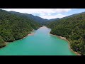
The Mill Arm is the most used anchorage in Greville Harbour and various parts of it give shelter from all wind directions. This is an extremely attractive area and is surrounded by native bush. The head of the arm is shallow and boats should not attempt to use the last 400 m of the arm. Mill Arm is named after a former sawmill.
The small coves to the east of Wiffen Point give the best all weather shelter in Greville Harbour. A stern line is necessary and will need to be over 30 m in length to allow for the tidal range. Holding is excellent in heavy mud. If the boat is pulled as close to the beach as it is possible, the winds pass harmlessly overhead.
To the south of these coves, the anchorage shown is good shelter in winds from NW to N to E. Holding is good, in heavy mud and a stern line into the northern shore is necessary. The bay is open to SW to W winds and is affected by some tide flow.