Search Results for: fc points fc 26 ps5 Besuche die Website Buyfc26coins.com. Problemlos, yeah!.c0QI
Temporary Exclusion Zone - Okiwi Bay Fireworks Display
Harbour Notice 18-2025 – NtM 18-2025(T)
Temporary Exclusion Zone
Okiwi Bay Fireworks Display
In accordance with the Navigation Bylaws, Clause 3.11, Okiwi Bay (designed area only) is temporarily reserved for a fireworks display from:
2.00 pm 1 January to 11.00 pm 1 January 2025
For safety reasons, during this time, unauthorised vessels and persons are requested to keep clear of the reserved area as directed by events officials.
The Navigation Bylaw can be viewed on the Marlborough District Council website www.marlborough.govt.nz search for navigation bylaws.
If you would like… More
Temporary Exclusion Zone - MV Bliss New Years Eve Fireworks Display
Harbour Notice 17-2024 – NtM 17-2024(T)
Temporary Exclusion Zone - AMENDED TIME
MV Bliss New Years Eve Fireworks Display
In accordance with the Navigation Bylaws, Clause 3.11, Anchorage No. 2 (designed area only) is temporarily reserved for fireworks display from:
9.00 pm 31 December to 1.00 am 1 January 2025
For safety reasons, during this time, unauthorised vessels and persons are requested to keep clear of the reserved area as directed by events officials.
The Navigation Bylaw can be viewed on the Marlborough District Council website www.marlborough.govt.nz search… More
Temporary Exclusion Zone - Picton New Years Eve Fireworks Display
Harbour Notice 16-2025– NtM 16-2025(T)
Temporary Exclusion Zone
Picton New Years Eve Fireworks Display
In accordance with the Navigation Bylaws, Clause 3.11, Picton inner harbour (designed area only) temporarily reserved for fireworks display from:
11.00 pm 31 December to 12.45 am 1 January 2025
For safety reasons, during this time, unauthorised vessels and persons are requested to keep clear of the reserved area as directed by events officials.
The Navigation Bylaw can be viewed on the Marlborough District Council website www.marlborough.govt.nz search for navigation bylaw If you would… More
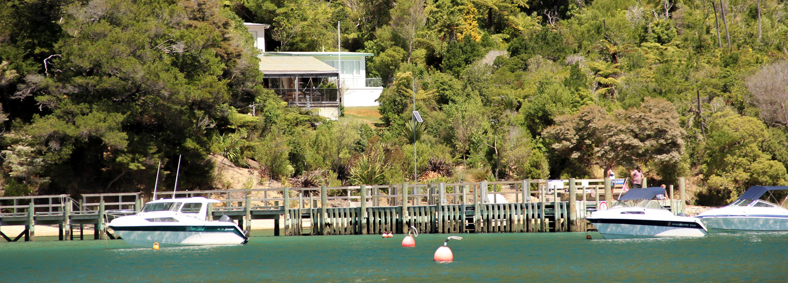
Long (Kokomohua) island
 View on Map
This beautiful island, named after its shape and considerable length, is a protected island and is surrounded by marine reserve. The diving and snorkelling here is exceptional with fish, crayfish and paua ranging in sizes that are considered rare outside of a marine reserve.
Despite its magnificence as a scenic conservation area, the island does pose a number of dangers to boaties. There are rocks ten metres out from the north-western shore and off all points along the south-eastern shore of this… More
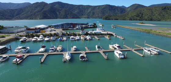
Havelock Marina
 View on Map
There is a 340 berth marina at Havelock. Visitors should berth at pier FJ1A and make arrangements at the marina office for short term berthing. There is ample parking, a café and a laundry at the marina. Fuel and water is available from the wharf and the town shops and any hotels are within easy walking distance. Note that deep draught vessels may find the approaches to Havelock difficult near LW.The Pelorus Boating Club has its clubhouse within the marina… More
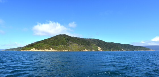
Blumine Island (Oruawairua)
 View on Map
This large island stands in the middle of Queen Charlotte Sound seemingly guarding it from the outer sea. The island is 295 meters high and two point three miles long from northern to southern tip. There are several shingle beaches around the whole coast and it is usually possible to find pleasant picnic spots on the leeward shores.
There is a DOC camp site on the south west side of the island. Blumine island is a DOC reserve so no dogs… More
About the Cruise Guide
The Cruise Guide to the Marlborough Sounds is an interactive App and website of marinas, anchorages, boat ramps, facilities, and other local features and knowledge presented visually on a smart map, together with imagery and nautical charts.
The Cruise Guide stands out from traditional, printed guide books because it is live and regularly updated. It provides the means to continually modify its content to include the latest available information.
Alldata entered is moderated by local experts and provides the type of information boaties and… More
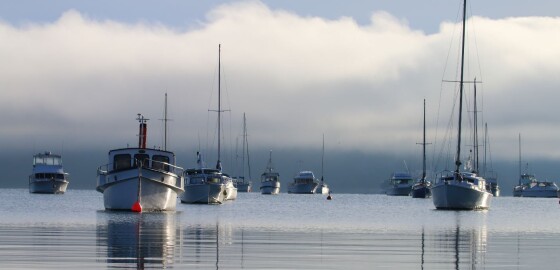
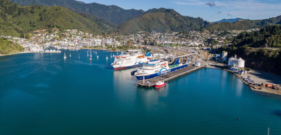
Picton Harbour
 View on Map
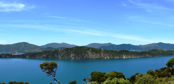
Waitohi/Picton is the focal point for the Queen Charlotte Sound.
It is a transport hub, connecting both North and South Island road and rail networks with ferries across Te Moana-o-Raukawa/the Cook Strait to the North Island.
The harbour is generally sheltered in most wind conditions, however, strong north-easterly and southerly winds can funnel into the Harbour and create considerable chop on the water.
There are a large number of moorings in the area of the town foreshore and care is necessary navigating here… More
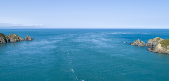
Tory Channel Entrance
 View on Map
Tory Channel also known as Kura Te Au separates Arapaoa Island from Te Waipounamu.
Tidal streams of up to seven knots flow through the entrance to and from Cook Strait. These tidal streams cause a great deal of turbulence, which can be very dangerous.
In N sector winds the Tory Channel entrance usually poses little problem. However, S sector winds generally create a heavy ground swell and this swell, meeting the shore line, piles up creating a steep sea.
If combined with a strong… More
Marine Farming Association
The Marine Farming Association is a subscription based organisation that represents marine farmers in the top of the South Island of New Zealand. The association's objective is to promote, foster, advance, encourage, aid and develop the rights and interests of its members and the marine farming industry in general.Farmers in this area of New Zealand grow approximately 80% of the marine products farmed in New Zealand. The major species include Greenshell mussels and king salmon. Other species include seaweeds, pacific oysters… More