The name of this bay means giant octopus. It stems from the Māori oral traditions of Kupe, a semi-legendary seafarer from Hawaiki, the traditional Māori place of origin, who explored New Zealand in the thirteenth century.
While exploring New Zealand, Kupe discovered the Tory Channel/ Kura Te Au. In the channel, Kupe met the giant octopus Te Wheke-a-Muturangi, a creature he had fought previously during his voyage. A fierce battle ensued, with Kupe and his crew hacking at Whekenui’s tentacles with weapons.
The giant octopus, Whekenui, was finally killed with a massive downwards blow to the head, known as an arapaoa. The death of Whekenui has been commemorated in the naming of several landmarks, including Whekenui Bay, the location of the creature’s death.1
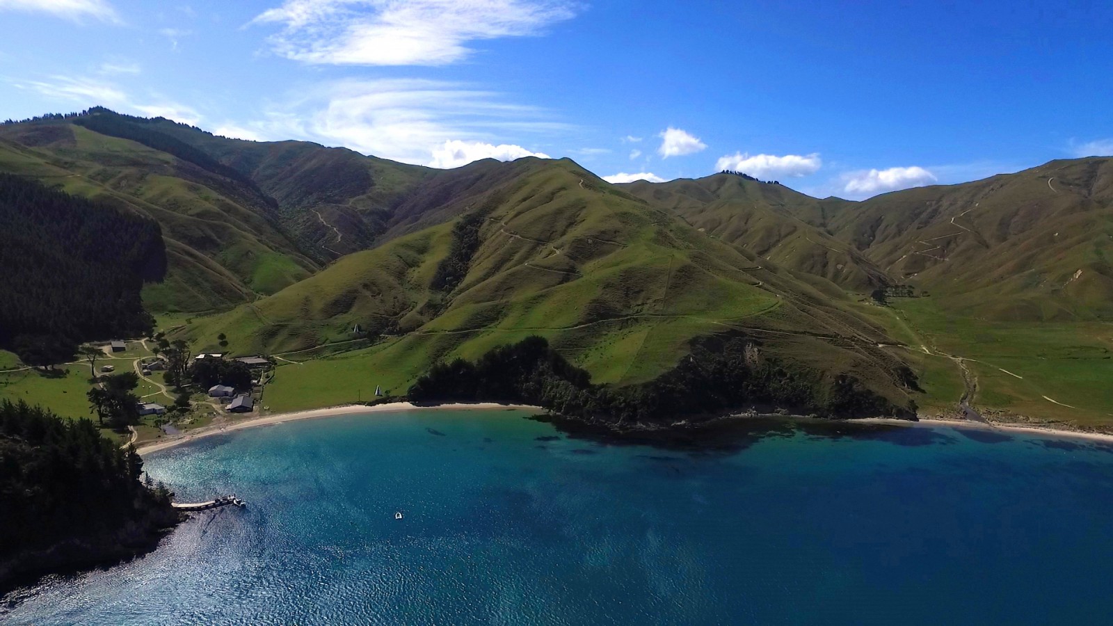
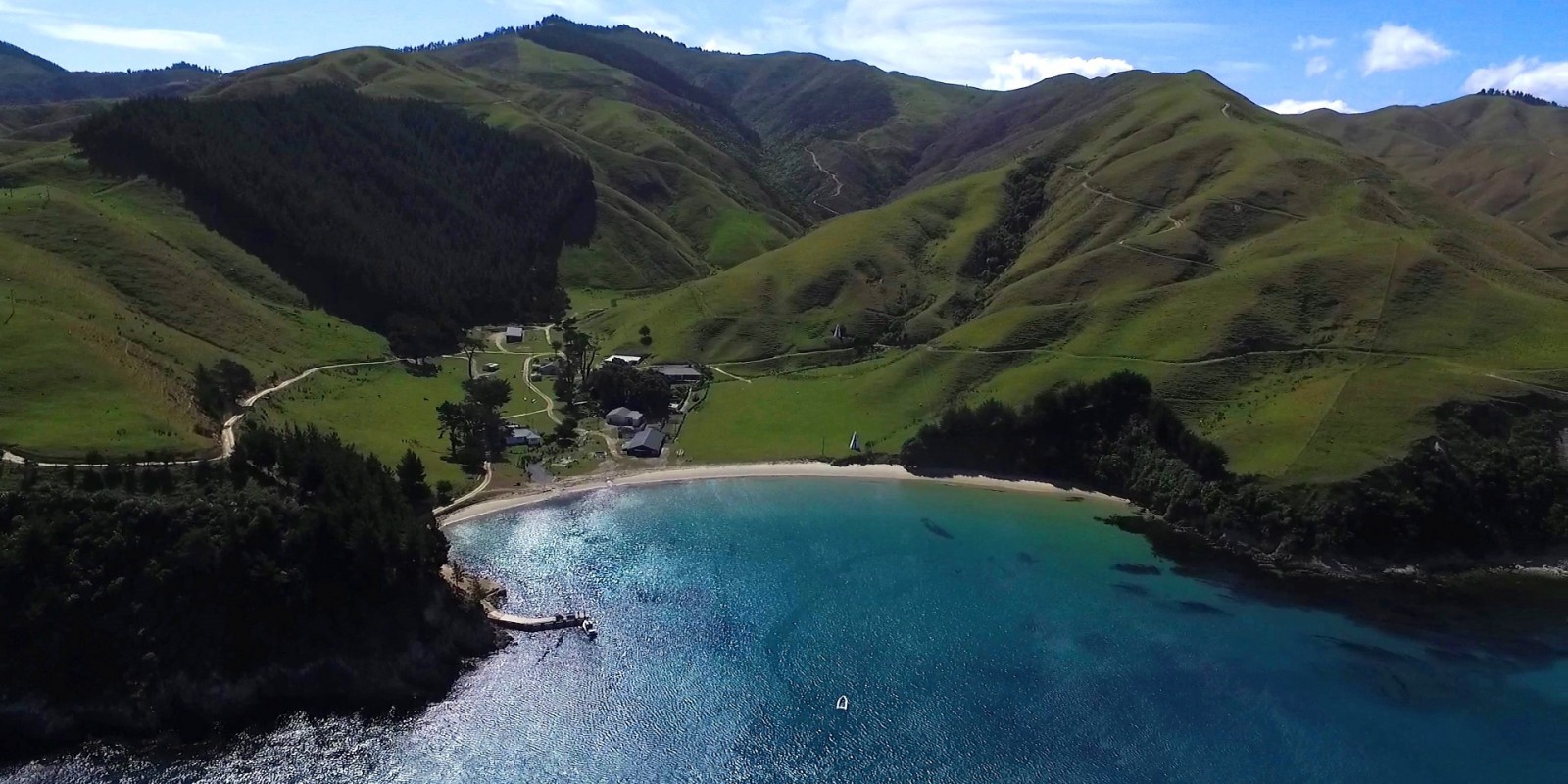
Whekenui Bay has a long history of human settlement. Oral, written and archaeological records all indicate that pā, fortified settlements, have been in the area since at least the time of Captain Cook’s voyages.
Descriptions from 1774 note the presence of a pā in the vicinity of Whekenui and Okukari Bays. It is likely this pā and one across the channel on the southern side of Tory Channel were used unsuccessfully as refuges by local Māori during the 1829 to 1830 invasion of the top of the South Island/Te Tau Ihu by the coalition of North Island iwi under the chief Te Rauparaha.2
The Māori tribe or iwi, Te Ātiawa o Te Waka-a-Māui, is closely associated with Whekenui Bay. The iwi settled here in 1828. Approximately 150 people settled in the bay at this time, creating extensive fenced gardens for potatoes and taro and also raising livestock.3
Following the arrival of Europeans, inhabitants of the bay became involved in both missionary and whaling activities. The Methodist missionary, the Reverend Samuel Iornside preached to congregations of several hundred people in the bay and oversaw the construction of a chapel in the village in 1843.4 Māori from the village worked on nearby whaling stations at Te Awaiti and Fishermans Bay and whalers also settled in the Whekenui Bay, leasing flat land for farming from various Māori owners from the mid-1860s onwards.5
As the population of the Marlborough Sounds increased due to the whaling and farming industries, so too did the use of the Tory Channel/ Kura Te Au and the need for a coastal safety system. In 1881 the Tory Channel Leading Lights were built by the Marine Department in Whekenui Bay. Leading lights are a pair of light beacons, used in navigation to indicate a safe passage for vessels entering a narrow channel, such as the entrance to Tory Channel/ Kura Te Au.
The lights were housed in two identical timber pyramidal structures, approximately 6.4 metres high and 3.3 metres square, with a window on the front face. The front light is about 7 metres above and 11 metres behind the high water mark, the rear light 27 metres above and 166 metres behind the high water mark. The two lights are 151 metres apart. When a ship's master aligns them the ship is able to make the passage.
The lights were de-manned in 1930 when the lights were changed from a kerosene lamp to gas. Electricity was introduced in 1945, in the form of batteries, a power source that is still used today.6
During the Second World War, the army rented land at Whekenui Bay. They established a camp of nearly ninety men, who erected and maintained six shore gun emplacements in strategic positions. After the war, buildings from the camp were relocated to Fishermans Bay to house workers at the whaling station.7
1. Hilary Mitchell and John Mitchell, Te Tau Ihu O Te Waka: a History of Maori of Nelson and Marlborough: Volume 1: Te Tangata me Te Whenua- the People and the Land (Wellington: Huia, 2004) 32.
2. Tristan Wadsworth, “The spatial distribution of pā in Tōtaranui/Queen Charlotte Sound, New Zealand”, Thesis, Master of Arts, University of Otago, 2015. Accessed, September 25, 2018 from http://hdl.handle.net/10523/5734 .
3. Marlborough District Council, Nelson City Council and Tasman District Council, “Te Tau Ihu Statutory Acknowledgements 2014”, accessed July 18, 2018, http://www.nelson.govt.nz/assets/Environment/Downloads/TeTauIhu-StatutoryAcknowledgements.pdf , 104.
4. Wesley A. Chambers, Samuel Ironside in New Zealand, 1839-1858 (Auckland: Ray Richards, 1982) 108, 116, accessed, July 31, 2018, http://www.methodist.org.nz/files/docs/wesley%20historical/samuel%20ironside%20in%20nz.pdf .
5. Loreen Brehaut, “Whekenui Leading Lights”, the Prow, accessed November 14, 2018, http://www.theprow.org.nz/yourstory/whekenui-leading-lights/#.W-tZX5MzbIU .
6. “Tory Channel Leading Lights”, Heritage New Zealand, accessed, March 13, 2023, http://www.heritage.org.nz/the-list/details/7701 .
7. R Doreen Caygill, “The Te Awaiti whaling station: An essay on whaling in and around Cook Strait, New Zealand”, (University of Canterbury: 1948), accessed, September 18, 2018, https://ir.canterbury.ac.nz/handle/10092/7222 .